Tuesday, September 27, 2016

Lab 3


Lab 3: Hadleyville Cemetery

Introduction:
Hadleyville Cemetery in Eau Claire, Wisconsin is facing a large problem. All records of the grave site locations have been lost.
Luther Barnard
Figure 1: An example of a headstone half buried and not legible
 Many of the graves are very old and half buried as seen in figure 1. This is a major issue because the owner of the 1.5 acre plot needs to know if there is someone buried in a grave site or not. It would be quite unfortunate if someone started digging up a grave and bones start appearing. 

As a class, we each built a GIS of the cemetery and placed a point on each head stone marking the grave site. A simple map, spreadsheet, or an aerial photograph would not be accurate nor precise. The GIS takes a aerial image and incorporates the hard data that was recorded in the field. The overall approach to creating the GIS was taking the UAS image and geocoding the points with the data we, as a class, recorded in the field. We used the aerial image and the spreadsheet with the hard data to join together the data to create a GIS of the grave site locations. 

There were many attributes that we had to standardized as a class before we could join the spread sheet to the GIS. We decided the following attributes were appropriate: whether the headstone was legible or not, last name, first name, middle initial (in that order), year of birth, year of death, and the occupancy number of the headstone. Many headstones are in pairs, killing two birds with one stone. 


Study Area: 
The Hadleyville Cemetery is located on County Road HH by Lowes Creek Road in Eau Claire County, Wisconsin. Figure 2 below is a visual reference of the surrounding area. The cemetery is 1.5 acres which is relatively small. There are roughly only 150 grave sites in the cemetery.
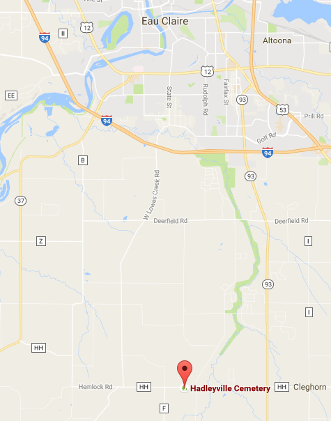
Figure 2: A reference map showing the location of the Hadleyville Cemetery
The data was collected in late summer/early fall in 2016. Shadows of large surrounding trees caused a problem when taking aerial photographs as well as interfering with the surveying GPS.


Methods:
In order to conduct our survey of the cemetery, our class needed to use a UAS and and GIS to put all of the data together. We took aerial pictures and joined that with the recorded data we gathered from the field. Initially, there was a problem with a partially covered area with trees, but we were able to work around it. The other large problem we ran into was the large amount of shadow covered area in the first flight for the UAS. It would have been easier in the long run if we would have tried to be more accurate in the beginning. We all recorded data in our note books. A pure digital approach is not ideal. It is ideal to have a reliable copy of the data for back up. To get the hard copy of data into the GIS, we had to create an Excel file that was shared among the class. We one common Excel file to standardize the attributes as much as possible and in turn, that eliminates much of the human error. Once the data was in the GIS, a simple join connected the two types of data we collected: the grave information and the grave site on the aerial image.


Results/Discussion:
The map below (figure 3) is what was created based off of the UAS image as a background and the grave site locations being represented by red points.
Figure 3: A map of the grave site locations at the Hadleyville Cemetery
The attribute table below (figure 4) should be nearly identical to the rest of the students in the 336 class because we standardized the attributes in the Excel spreadsheet. Each person, however, had to create their own map with their own table joined in their map, so the potential for a slightly different looking attribute table is possible.
Figure 4: The standardized attribute table with the data we entered as a class
Gathering the data in the field took a lot less time than creating the GIS and entering in all of the collected data. It was very time consuming and tedious work to enter in the data while also maintaining a standardized list of attributes. Communication was key when it came to figuring out problems with classmates. If we had to re-do this lab in the future, I think it would be wise to have one person collect all of the data for each specific attribute. This would cut down on a lot of the work while also maintaining a degree of accuracy and standardization.


Conclusion:
The mixture of formats used for this project have an impact on the accuracy and expediency of the survey. The more formats and outside information being joined together results in a less accurate survey and increases the chances of error to occur. Since the project was on such a small scale, being extremely accurate was overkill. The size of our study area was only 1.5 acres, so we were very accurate based off our our study size.
In my opinion, the survey was a complete success. The main problem of lab 3 was that there was no record of the grave sites at the Hadleyville Cemetery and they needed a map, and a map is what they will get (19 maps specifically).


Sources:
  • http://www.findagrave.com/cgi-bin/fg.cgi?page=gr&GScid=88086&GRid=21381871& 
  • www.google.com/maps
  • ESRI data


Tuesday, September 20, 2016

Lab 2

Lab 2

Introduction
o Provide background to the problem at hand. What are the problems and challenges facing Hadlyville cemetery?
All original records and maps of the Hadleyville Cemetery have been lost. There are multiple burials with out any identification markings, and stones dating back to 1800 that are difficult to read. Our 336 class has to figure out a way to map the headstones and burial plots.

o Why is building a GIS of this project better than a simple map and/or spreadsheet?
A GIS will have exact locations with exact coordinates of burial plots occupied as well as unoccupied.

o What equipment are you going to use to gather the data needed to construct the GIS; ie what is the overall approach?
The approach is to take the aerial image and join it with the GPS coordinate points taken in the field.
Only a few points were taken by GPS, so the rest of the headstones must be marked on the aerial image.

o What are the overall objectives of the method being employed to gather the data.
The goal of the proposal is to identify as many stones and burial sites as possible. The UAS took an image that we, as a class, will use to make a map of the headstones in a GIS.


Methods
o What combination of geospatial tools did the class to use in order to conduct the survey? Why?
A surverying GPS to collect the coordinate points (for four rows)
A UAS to capture the 1.5 acre field in an aerial image
A GIS to join together the aerial image and the coordinate points to get an accurate layout of the cemetery.

o What is the accuracy of the equipment you are intending to use? (Be sure to cover each piece of equipment)
Drone: ~1 meter
Surveying GPS: ~10 cm

o How was data recorded? List the different methods and state why a pure digital approach is not always best. What media types are being used for data collection? Formats?
Some data was written down by students. Some people took pictures of the headstones as a backup. A pure digital approach is not the best because the image might get lost or data might become altered. A hard written copy is always good to have on hand.

o How will you transfer the data you gather into a GIS
Put the coordinates into an excel file and the join the data into a GIS with the aerial image in the background.

o What equipment failures occurred if any? What was done to remedy the situation?
The surveying GPS took way to much time, so we stopped using it after the completion of row four. The surveying GPS was not entirely necessary because we did not need that precise of a reading. The UAS was the major piece of equipment that was needed.

o What might have been done to facilitate data collection in terms of equipment and refining the method?
As a class we could have worked together more to figure out who was recording certain rows or taking pictures. We also didn't exactly need the surveying GPS because of the images we took in the air.


Conclusion
o How did the methods transfer to the overall objectives of the project?
o How did the mixed formats of data collection relate to the accuracy and expediency of the survey?
o Describe the overall success of the survey, and speculate on the outcome of the data.

Wednesday, September 7, 2016

Lab 1

Lab 1
INTRODUCTION:

oWhat are the problems and challenges facing Hadlyville cemetery?
All original records and maps of the Hadleyville Cemetery have been lost. There are multiple burials with out any identification markings, and stones dating back to 1800 that are difficult to read. Our 336 class has to figure out a way to map the headstones and burial plots.

o Why is the loss of original maps and records a particular challenge for this project.
We do not know for sure if there are any actual open land plots. There might be some headstones that are so overgrown we might not even seen them. This is a problem because there could be a buried person we do not know about and it would not get marked on the map. One land plot could potentially be occupied by two permanent residents if we are not careful.

o How will GIS provide a solution to this problem?
GIS allows us to join together the aerial shot of the cemetery and the GPS coordinates of grave sites to the raster.

o What makes this a GIS project, and not a simple map?
It incorporates the field attribute data gathered in multiple forms joined together to create a map.

o What equipment are you going to use to gather the data needed to construct the GIS?
A cellphone for pictures, a drone for the aerial picture, and a surveying GPS unit.

o What are the overall objectives of your proposal?
The goal of the proposal is to identify as many stones and burial sites as possible.


METHODS:

o What is the sampling technique you chose to use? Why?
As a class we split up duties and took pictures of the headstones and wrote down the information on each headstone. We needed to keep a hard copy of the data for a backup of the digital data.

o What is the accuracy of the equipment you are intending to use?
Drone: ~1 meter
Surveying GPS: ~10 cm

o How was the data entered/recorded? Why did you choose this data entry method?
The UAS took aerial pictures of the cemetary. We all took pictures and wrote down the data.
Most of the class took notes in their field notebooks. A few students took pictures, and two students took the surveying GPS and took points for four rows of headstones. We wanted to make sure we had more than just virtual corrdinate points. We took pictures in case something was not right with the written data or the virtual data got lost or destroyed.

o How will you transfer the data you gather into a GIS
All of the hand written information can be put into an excel document and that can be expored and joined spatially to the aerial image in a GIS.

o What drawbacks are there to the method you propose? How to the pros outweigh the cons of this method?
The major drawback is that multiple people have only bits and pieces of the written data. It took very little time to retrieve a row or two of data, and the plot of land is not very big, so the numbers should not get too confusing.


CONCLUSION:
o How do your methods transfer to the overall objectives of your proposal?